Showing posts with label map. Show all posts

Monday, December 11, 2006

Evidence of an Ask.com mapping API?

Along with a lot of other people, we've been anxiously awaiting any news about an Ask.com mapping API. Why? Because Ask.com provides much better satellite imagery than Google. Check it out yourself. We REALLY want that on MyOutdoors.net.

So, what makes us think there's an API on the way? Well, IAC/InterActiveCorp, the ownerof Ask.com, also owns Evite, where the new Ask.com maps are now being used. I just happened to get an evite recently and and pulling up the source from a map on the evite shows us this little beauty:

<script type="text/javascript" 
src
="http://api.syndication.ask.com/maps/maps1.1.js"
<
\script>

Well I did a wget on the file and a little bit of hacking to try to run it off of our local server, just to see if it would work. I got everything running, but no imagery :( I didn't look into it much further since I'm guessing they designed it that way.

Wednesday, November 15, 2006

MyOutdoors.net on Television! - WKOW Madison, WI - 10:00 P.M. Sunday, November 18, 2006

Apparently the Isthmus article generated a little more buzz than we thought. We were pretty surprised when WKOW asked us for an interview. I don't think I've personally been interviewed on TV before. Hopefully I don't acti like a fool...

Anyway, to all you Madisonians, watch us on TV! 10:00 P.M. Sunday, November 18, 2006 on WKOW, the local ABC station.

Thursday, November 09, 2006

Oh, how we love the Isthmus!

We were recently fortunate enough to have David Medaris of the Isthmus interview us here at MyOutdoors.net. It's the first real publicity the site has received so we're incredibly excited about it. David wrote a fantastic article and really made an effort in describing what we're all about. Go check it out.

Thanks, David!

Thursday, October 26, 2006

Search for journal entries by location!

Continuing our quest to implement the most fully featured community mapping site available, we just completed location-based searching of journal entries on MyOutdoors.net. This feature integrates into the site extremely well, with lots of different options for finding journal entries.

To start, there is now a link at the bottom of every journal entry that says "Find nearby journal entries." It's right next to the distance field and looks like this:

The link will take you to the location search page to display all of the journal entries that are close by. It currently uses a default search radius of 150 miles (apologies to all you metric folks out there). It's kind a wide range, but we thought that you would want to see something rather than nothing, and for journal entries out in the middle of nowhere, it could be useful. Also, they're sorted by distance so the closest ones show up first. Once you're on the search page, you can change the search radius, or enter new search criteria.

Search criteria can be anything that Google can geocode, including cities, states, zip codes, etc. You can even enter a longitude and latitude. One of the cool things about it is that if you could link to the location page directly, passing in three parameters in the querystring. Just use http://www.myoutdoors.net/location.php? The parameters are:

lat (in degrees)
lng (in degrees)
distance

And then you can see all the journal entries that took place nearby.

There is also a new Location-based Search box on the Browse page. This is the entry to the location search for other search criteria.

Enjoy!

Tuesday, October 17, 2006

KML Downloads


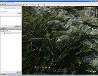
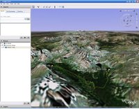
We recently added KML downloads to MyOutdoors.net. I didn't realize how cool they were until I started implementing them. The KML specification has matured over time and is now at a 2.0 release. KML stands for Keyhole Markup Language, an acronym that endured Google's acquisition of Keyhole in 2004. The KML specs allow for some serious mapping annotations. Some of the cooler things are 3d paths, polygons, HTML annotations, custom overlays (ground and screen) and serving content from remote locations. Really the best thing about KML though is that you can put your own data into Google Earth's amazing 3d interface.

We've really only touched the surface with our KML implementation. As we have the time we'll try to add some of the more advanced features of KML. Downloading KML from MyOutdoors.net will get you a KML document that has your path and a placemark for every waypoint in your journal entry that has been annotated. The view should then be centered at the normal centering point for the journal and the camera tilted at a 45 degree angle. Seeing a path set atop the 3d terrain with satellite images gives you a very good idea of what the author's journey was really like.


I hope you all enjoy the new feature. Look for some enhancements to KML files on MyOutdoors.net in the near future.