
We recently added KML downloads to MyOutdoors.net. I didn't realize how cool they were until I started implementing them. The KML specification has matured over time and is now at a 2.0 release. KML stands for Keyhole Markup Language, an acronym that endured Google's acquisition of Keyhole in 2004. The KML specs allow for some serious mapping annotations. Some of the cooler things are 3d paths, polygons, HTML annotations, custom overlays (ground and screen) and serving content from remote locations. Really the best thing about KML though is that you can put your own data into Google Earth's amazing 3d interface.
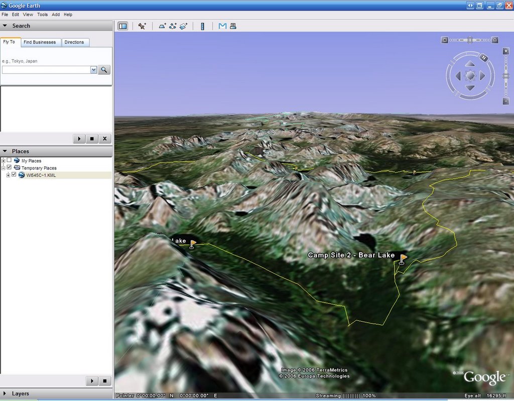
We've really only touched the surface with our KML implementation. As we have the time we'll try to add some of the more advanced features of KML. Downloading KML from MyOutdoors.net will get you a KML document that has your path and a placemark for every waypoint in your journal entry that has been annotated. The view should then be centered at the normal centering point for the journal and the camera tilted at a 45 degree angle. Seeing a path set atop the 3d terrain with satellite images gives you a very good idea of what the author's journey was really like.
I hope you all enjoy the new feature. Look for some enhancements to KML files on MyOutdoors.net in the near future.

1 comment:
what's wrong with your website myoutdoors.net?
every time i try and browse for a map it just brings up the same bike riding trail everytime (even if i select hiking or paddling).
it's ridiculous.
Post a Comment